
National Park Service News Release
FOR IMMEDIATE RELEASE: DATE: June 26, 2013
CONTACT: Cyndy M. Holda, Public Affairs Specialist, 252-475-9034 or 252-473-2111
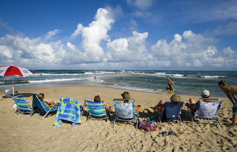
Cape Hatteras National Seashore Proposal to Facilitate
Additional Public Beach Access Opens for Public Comment
Announced today by National Park Service Outer Banks Group Superintendent Barclay Trimble, the public comment period for the Cape Hatteras National Seashore proposal to facilitate additional public beach access environment assessment will open July 1, 2013 through August 2, 2013.
The Proposal to Facilitate Additional Public Beach Access project presents evaluation of two (2) alternatives for various improvements at the Seashore. “We invite everyone to comment on this document,” stated Superintendent Trimble. “Public participation is vital to the NPS planning process and we appreciate the time and energy the public devotes to commenting and suggestions during this public meeting/scoping that will be evaluated during this planning process.”
Following the comment period a decision on the action to be implemented will be determined. The final environmental assessment will guide park planning and prioritization of beach access infrastructure improvements in the years ahead.
The Proposal to Facilitate Additional Public Beach Access Environmental Assessment is available for public comment on-line at the NPS Planning, Environment, and Public Comment website:
http://parkplanning.nps.gov/beach_access
Public read-only copies of this document will be available at the NPS Visitor Centers at the Cape Hatteras Lighthouse, Bodie Island Lighthouse, Ocracoke, Fort Raleigh National Historic Site, and Wright Brothers National Memorial; the Dare County Libraries in Hatteras Village, Manteo, and Kill Devil Hills; and the Ocracoke Library. Copies of this document will be available at the scheduled public meetings while supplies last.
Written comments may also be mailed to: Proposal to Facilitate Additional Public Beach Access, c/o Superintendent, Outer Banks Group, 1401 National Park Drive, Manteo, NC 27954.
Comments must be received by 5:00 p.m. on August 2, 2013.
-NPS-
Cape Hatteras National Seashore
Resource Management Field Summary
July 2, 2013
*All numbers are preliminary and the data will
be reviewed before they are finalized.
Piping Plover Summary:
|
Location |
# Nests to Date |
# Active Nests |
# Active Broods |
# Fledglings |
|
Bodie Island |
0 |
0 |
0 |
0 |
|
Cape Point |
7 |
0 |
2 |
2 |
|
South Beach |
0 |
0 |
0 |
0 |
|
North Ocracoke |
0 |
0 |
0 |
0 |
|
South Ocracoke |
2 |
0 |
0 |
0 |
|
Total |
9 |
0 |
2 |
2 |
Wilson’s Plover Summary:
|
Location |
# Nests to Date |
# Active Nests |
# Active Broods |
# Fledglings |
|
Bodie Island |
0 |
0 |
0 |
0 |
|
Cape Point |
0 |
0 |
0 |
0 |
|
South Beach |
0 |
0 |
0 |
0 |
|
North Ocracoke |
1 |
0 |
1 |
0 |
|
South Ocracoke |
2 |
0 |
0 |
1 |
|
Total |
3 |
0 |
1 |
1 |
American Oystercatcher Summary:
|
Location |
# Pairs |
# Nests to Date |
# Active Nests |
# Active Broods |
# Fledglings |
|
Bodie Island |
2 |
4 |
1 |
0 |
0 |
|
Green Island |
3 |
6 |
0 |
2 |
0 |
|
Hatteras Island |
14 |
23 |
1 |
3 |
1 |
|
Ocracoke Island |
9 |
9 |
0 |
5 |
2 |
|
Total |
28 |
42 |
2 |
10 |
3 |
Colonial Waterbirds:
|
Location |
# Active Colonies to Date |
# Currently Active Colonies |
|
Bodie Island |
2 |
2 |
|
Green Island |
1 |
1 |
|
Hatteras Island |
12 |
7 |
|
Ocracoke Island |
3 |
3 |
|
Total |
18 |
13 |
Sea Turtles:
|
Location |
# Nests |
# False Crawls |
|
Bodie Island |
2 |
3 |
|
Hatteras Island |
62 |
78 |
|
Ocracoke Island |
26 |
25 |
|
Total |
90 |
106 |
Summary Mileage Table
- As of 7/3/2013
Bodie Island Area 5.74
Open to ORVs 2.19
Closed for Resource Protection 0.87
Open to Pedestrians 2.69
Hatteras Island 40.46
Open to ORVs 8.15
Closed for Resource Protection 7.55
Open to Pedestrians 24.76
Ocracoke Island 17.87
Open to ORVs 7.64
Closed for Resource Protection 4.37
Open to Pedestrians 5.85
Total Ocean & Inlet Shoreline 64.07
Total Miles Open to ORVs 17.98
Total Miles Closed for Resource 12.80
Total Miles Open to Pedestrians (Only) 33.30
Total Miles Open to Pedestrians (Includes ORV areas) 51.27
Ramp by Ramp open access for ORV traffic (Updated 07-03-2012)
(Bodie Island Total-2.2 miles open)
Ramp 4 NORTH 1.85 mi. OPEN
Ramp 4 South .35 mi. open
(Hatteras Total – 7.80 miles open)
Ramp 23 CLOSED Til 11-1-12
Ramp 27North .40 Miles CUL-DA-SAC open Ramp 27 to Ramp 30 CLOSED
Ramp 30 South 2.1 miles open
Ramp 34 CLOSED
Ramp 38 South 0.9 miles open
Ramp 43 CLOSED
Ramp 44 to Cape Point CLOSED
Ramp 45 CLOSED
Ramp 49 East 1.7 miles open
Ramp 49 West to Frisco Village Line 1.1 miles open
Ramp 55 West beach shoreline 1.6 miles open
Ramp 55 Interdunal (Pole) Road with small
sound-side access behind Coast Guard Base 2.3 miles open but
Spur Road and Cable Crossing this is not
beach access
Ocracoke Total – 7.5 miles open
Ramp 59 North CLOSED
Ramp 59 South 2.4 miles open
Ramp 67 North 1.0 miles open
Ramp 67 South 0.7 miles open
Ramp 68 CLOSED\
Ramp 70 North 0.4 miles
Ramp 70 TO RAMP 72 1.7 miles open
Ramp 72 South 1.3 miles open
These are rough numbers only. Some of these miles are too narrow
to drive safely.
TOTAL ORV ACCESS CAPE HATTERAS NATIONAL SEASHORE
17.50 MILES OPEN
Per NPS Google Map!!!!!!!!!