
Cape Hatteras National Seashore
Resource Management Field Summary for May 13, 2014
*All numbers are preliminary and the data will be reviewed before they are finalized.*
Piping Plover Summary:
|
Location |
# Nests to Date |
# Active Nests |
# Active Broods |
# Fledglings |
|
Bodie Island |
0 |
0 |
0 |
0 |
|
Cape Point |
4 |
4 |
0 |
0 |
|
South Beach |
0 |
0 |
0 |
0 |
|
North Ocracoke |
0 |
0 |
0 |
0 |
|
South Ocracoke |
0 |
0 |
0 |
0 |
|
Total |
4 |
4 |
0 |
0 |
Wilson’s Plover Summary:
|
Location |
# Nests to Date |
# Active Nests |
# Active Broods |
# Fledglings |
|
Bodie Island |
0 |
0 |
0 |
0 |
|
Cape Point |
0 |
0 |
0 |
0 |
|
South Beach |
0 |
0 |
0 |
0 |
|
North Ocracoke |
0 |
0 |
0 |
0 |
|
South Ocracoke |
1 |
1 |
0 |
0 |
|
Total |
1 |
1 |
0 |
0 |
American Oystercatcher Summary:
|
Location |
# Pairs |
# Nests to Date |
# Active Nests |
# Active Broods |
# Fledglings |
|
Bodie Island |
1 |
0 |
1 |
0 |
0 |
|
Green Island |
3 |
2 |
13 |
0 |
0 |
|
Hatteras Island |
14 |
12 |
10 |
0 |
0 |
|
Ocracoke Island |
8 |
6 |
3 |
0 |
0 |
|
Total |
26 |
22 |
16 |
0 |
0 |
Colonial Waterbirds:
|
Location |
# Active Colonies to Date |
# Currently Active Colonies |
|
Bodie Island |
0 |
0 |
|
Green Island |
1 |
1 |
|
Hatteras Island |
8 |
8 |
|
Ocracoke Island |
0 |
0 |
|
Total |
9 |
9 |
Sea Turtle Nests and False Crawls:
|
Location |
# Nests |
# False Crawls |
# Nests Hatched to Date |
|
Bodie Island |
0 |
0 |
0 |
|
Green Island |
0 |
0 |
0 |
|
Hatteras Island |
0 |
2 |
0 |
|
Ocracoke Island |
0 |
0 |
0 |
|
Total |
0 |
2 |
0 |
Summary Mileage Table –
As of 5/13/2014
Bodie Island Area 5.74
Open to ORVs 2.19
Temporarily Closed for Resource Protection 0.37
Open to Pedestrians 3.18
Hatteras Island 40.46
Open to ORVs 9.44
Temporarily Closed for Resource Protection 7.39
Open to Pedestrians 23.65
Ocracoke Island 17.87
Open to ORVs 7.73
Temporarily Closed for Resource Protection 3.16
Open to Pedestrians 6.98
Total Ocean & Inlet Shoreline 64.07
Total Miles Open to ORVs 19.36
Total Miles Temporarily Closed for Resource Protection 10.92
Total Miles Open to Pedestrians (Only) 33.79
Total Miles Open to Pedestrians (Includes ORV areas) 53.15
Open To Sum of Mileage
Ramp Accessibility –
As of 5/7/2014
Ramp Open To:
ORVs Pedestrians
01 No Yes
02 No Yes
04 Yes Yes
23 No No
27 Yes Yes
30 Yes Yes
34 No No
38 Yes Yes
43 Yes Yes
44 Yes Yes
45 No No
49 Yes Yes
55 Yes Yes
59 Yes Yes
67 Yes Yes
68 No Yes
70 Yes Yes
72 Yes Yes
Ramp by Ramp open access for ORV traffic (Updated 05/8/2014)
(Bodie Island Total-2.2 miles open)
Ramp 4 NORTH 1.85 mi. OPEN
Ramp 4 South .35 mi. open
(Hatteras Total – 8.9 miles open)
Ramp 23 CLOSED Til 11-1-14
Ramp 27North 0.45 MILES open
Ramp 27 to Ramp 30 CLOSED
Ramp 30 South 2.1 miles open
Ramp 34 CLOSED
Ramp 38 South 1.35 miles open
Ramp 43 CUL-DA-SAC .10 MILES OPEN
Ramp 44 SOUTH .50 OPEN TO SOUTH OF NARROWS
CAPE POINT - CLOSED
Ramp 45 CLOSED
Ramp 44 shows being open to the road behind the dunes, but it goes “NOWHERE” and should not be listed as access. You cannot even walk to the south beach from the area open for diving.
Ramp 49 East 1.7 miles open
Ramp 49 West to Frisco Village Line 1.1 miles open
Ramp 55 West beach shoreline 1.6 miles open
Ramp 55 Interdunal (Pole) Road with small
sound-side access behind Coast Guard Base, Spur Road and Cable Crossing but
this is not beach access 2.9 miles open
Ocracoke Total – 7.5miles open
Ramp 59 North CLOSED
Ramp 59 South 2.85 miles open
Ramp 67 North 0.4 miles open
Ramp 67 South 0.7 miles open
Ramp 68 CLOSED\
Ramp 70 North 0.4 miles
Ramp 70 TO RAMP 72 1.7 miles open
Ramp 72 South 1.45 miles open
These are rough numbers only. Some of these miles are too narrow to drive safely.
TOTAL ORV ACCESS CAPE HATTERAS NATIONAL SEASHORE
18.6 MILES OPEN
Per NPS Google Map!!!!!!!!!
National Park Service News Release
FOR IMMEDIATE RELEASE: DATE: April 30, 2014
CONTACT: Cyndy M. Holda, Public Affairs Specialist, 252-475-9034
Cape Hatteras National Seashore Night Driving
Restrictions Go Into Effect May 1st
Superintendent Barclay Trimble reminds park visitors that night beach driving restrictions for ORV use on Seashore ocean beaches go into effect Thursday, May 1, 2014 at 9:00 p.m. From May 1 – September 14, ORV routes on ocean beaches are closed to ORVs from 9:00 p.m. to 7:00 a.m. during the sea turtle nesting season. Beginning September 15 to November 15, 2014, ORV routes will reopen when there are no sea turtle nests remaining on that route or portion of the route.
In addition, from May 1 to November 15, beach fires are limited to the following ocean beaches in front of:
- Coquina Beach parking lot
- The villages of Rodanthe, Waves, Salvo, Avon, Buxton, Frisco and Hatteras
- Ocracoke Day Use area
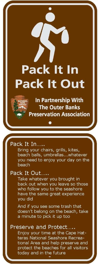
In general, fires are allowed from 6:00 a.m. to 10:00 p.m. and a fire permit is required. To obtain the free beach fire permit, visit one of the three ORV permit offices, any of the park campgrounds or visitor centers, or available on-line at: http://www.nps.gov/caha/planyourvisit/beach-fire-permit. The beach fire permit is valid only when a responsible adult (18 years of age or older) is present. Fires, no greater than 3 feet in diameter, may be ignited and maintained seaward of the ocean dune, below the high tide line and at least 50 feet from any vegetation. Fires cannot be left unattended and must be completely extinguished (cold to touch) upon termination of use. Clean area of all trash before leaving the beach and remember the “pack in/pack out” practice of leaving national seashore beaches in a clean and safe condition for the next visitor.
As the turtle nesting season proceeds, park visitors will encounter localized sea turtle nest protection areas. These areas are posted on-site and closed to ORVs, pedestrians, and pets.
Fireworks and metal detectors are prohibited. Pets must be on leashed at all times.
For further information, please call (252) 473-2111 or check http://www.nps.gov/caha/planyourvisit/googleearthmap.htm