National Park Service Beach Access Report for July 1, 2010
FOR IMMEDIATE RELEASE: July 1, 2010
CONTACT: 252-473-2111, ext. 148
Cape Hatteras National Seashore beaches are being managed under the
terms of the U.S. District Court approved consent decree. Park visitors
can expect to see resource closures for breeding shorebirds in effect to
varying degrees from mid-March to mid-to-late-August and sea turtle
nesting closures may occur until early November. Shorebird pre-nesting
closures were established at the inlets, Cape Point, and South Beach in
March. As soon as subsequent breeding activity is observed, the consent
decree requires that automatic, non-discretionary buffers be
implemented.
As of July 1, 2010, of the constantly changing, fluctuating estimated 68
miles of ocean shoreline within Cape Hatteras National Seashore,
approximately 24.2 miles of ocean shoreline is open to ORV and
pedestrian access; approximately 27.1 miles of ocean shoreline is open
to pedestrian only access; approximately 2.7 miles of ocean shoreline
is considered “limited access” (areas that are open but may require
hiking off-trail to access; and approximately 15.1 miles of ocean
shoreline are temporarily closed to all public access due to shorebird
resource protection areas. The latest Google Earth beach access map can
be viewed at: http://www.nps.gov/caha/planyourvisit/googleearthmap.htm.
For more information, check the National Seashore’s website at:
http://www.nps.gov.
As of May 1, 2010, all Seashore beaches are closed to off-road vehicles
between the hours of 10:00 p.m. to 6:00 a.m. in accordance with the
court ordered consent decree. The 10:00 p.m. to 6:00 a.m. prohibition
on beach driving will remain in effect until November 15, 2010.
The annual seasonal closures of village beaches to off-road vehicle
(ORV) use within the National Seashore went into effect at 6:00 a.m. on
Saturday, May 15, 2010. Beach driving speed limits are reduced to 15
mph in all locations open to ORV use, unless otherwise posted, from May
15 through September 15. The ORV closures are established in village
beach areas that receive heavy pedestrian use, including areas adjacent
to Coquina Beach and the villages of Hatteras and Ocracoke Islands.
The Beach Access Report is issued every Thursday throughout the breeding
season and will briefly summarize the current status of access in each
section of the Seashore listed below. Updated news will be reported
weekly in bold, BLUE print.
Note: *All distances are approximate. The mileage is determined on a
weekly basis using GIS data and is divided geographically by island this
year. Closure conditions may change in the field on short notice.
On-site signage, rather than the Beach Access Report or the Google Earth
map, is the most accurate and current indication of what is open or
closed to the public. Closed areas are clearly marked in the field with
“symbolic fencing” consisting of wooden or carsonite posts, closure
signs, string, and flagging tape. Knowledge of tidal changes and
caution should be exercised while traveling the beaches of the park.
Pets are strictly prohibited in resource protection areas. Elsewhere,
pets must be physically restrained at all time on a leash not exceeding
6 feet in length. For more information, please contact:
This email address is being protected from spambots. You need JavaScript enabled to view it. or call 252-473-2111, ext. 148.
Bodie Island (Ramp 1 to Oregon Inlet; 5.7 miles of shoreline)
Mileage Summary: 3.1 miles open to ORVs and pedestrians; 1.3 miles open
to pedestrians only; 0.6 miles of limited access; 0.7 miles closed to
public access due to resource closures.
Ramp 1 - Ramp 2 (Coquina Beach Area) (1.2 miles)
Status: The beach is open for pedestrian access, but not for ORV
access.
Ramp 2 - Ramp 4 (2.4 miles)
Status: Ramp 2 is open for pedestrian access, but not for ORV access.
From Ramp 4 north, the beach is open for ORV and pedestrian access for
approximately 2.4 miles.
Ramp 4 – Oregon Inlet (Bodie Island Spit: 2.1 miles)
Status: The beach is open for ORV and pedestrian access 0.8 of a mile
south of Ramp 4, where a resource protection area precludes through
access to the inlet.
Hatteras Island (Village of Rodanthe south to Hatteras Inlet; 42.8 miles
of shoreline)
Mileage Summary: 16.2 miles open to ORVs and pedestrians; 17.1 miles
open to pedestrians only; 1.1 miles of limited access miles; 8.4 miles
closed to public access due to resource closures.
Villages of Rodanthe, Waves, and Salvo - Ramp 23: (Pea Island NWR
boundary to Ramp 23 – 5.3 miles)
Status: The beach is open for pedestrian access, but not for ORV access
in front of the villages of Rodanthe, Waves, and Salvo. There is
pedestrian access for 5.3 miles.
Ramp 23 - Ramp 27: (4.3 miles)
Status: Ramp 23 is closed to ORV and pedestrian access. A resource
closure extends from the Salvo Village boundary south of Ramp 23 and
precludes ORV and pedestrian access. There is approximately 2.6 miles
of ocean shoreline open for ORV and pedestrian access north of Ramp 27.
Ramp 27 - Ramp 30: (2.0 miles)
Status: The beach is open to ORV and pedestrian access at Ramp 27.
There is a resource protection 0.01 of a mile south of Ramp 27 that
precludes through access for ORVs and pedestrians. The beach is open
for ORV and pedestrian access for approximately 0.5 of a mile north of
Ramp 30.
Ramp 30 - Ramp 34: (4.3 miles)
Status: The beach is open for ORV and pedestrian access between Ramp 30
and 34.
Ramp 34 - Ramp 38: (3.9 miles)
Status: The beach is open for ORV access for approximately 0.4 of a
mile south of Ramp 34. The beach in front of Avon Village is open for
pedestrian access, but not for ORV access. There is pedestrian access
for 3.9 miles.
Ramp 38 - Ramp 43: (6.0 miles; includes the Haulover soundside & Buxton
Village)
Status: The beach is open to ORV and pedestrian access for 1.0 of a
mile south of Ramp 38, where a resource protection closure precludes
through access. Pedestrian access is open for approx. 1.0 mile north of
the Buxton Village boundary. From Ramp 43 north, the beach is open to
ORV and pedestrian access for 0.4 of a mile.
Ramp 43 - Ramp 44: (0.4 of a mile)
Status: The beach is open for ORV and pedestrian access.
Ramp 44 - Ramp 45: (Ramp 44 to tip of Cape Point: 1.0 miles; Cape Point
tip to Ramp 45: 1.4 miles)
Status: Ramp 44 is open and there is ORV and pedestrian access south
for approximately 100 meters. There is no ORV or pedestrian access to
the “hook”, which is temporarily closed. Salt Pond Road is closed.
Ramp 45 - Ramp 49: (South Beach: 3.4 miles)
Status: Ramp 45 is closed to ORV and pedestrian access. There is ORV
and pedestrian access east of Ramp 49 for 2.0 miles.
Ramp 49 - Ramp 55: (5.9 miles; includes Frisco and Hatteras Village)
Status: The beach is open to ORV and pedestrian use north of Ramp 49
and south of Ramp 49 for 1.2 miles to the Frisco Village line. There is
pedestrian, but not ORV, access from the Frisco village line to 0.1 of a
mile east of Ramp 55. In Sandy Bay Day Use area, a resource protection
closure was removed opening 0.5 of a mile soundside pedestrian access
adjacent to NC 12.
Ramp 55 - Hatteras Inlet: (Hatteras Inlet Spit: 2.6 miles)
Status: ORV and pedestrian access is open along the ocean shoreline
from Ramp 55 south/west for 1.9 miles. The Pole Road is open to ORV and
pedestrians from Ramp 55 to the north end of the Isabel overwash area
where traffic is routed onto the beach due to a pre-nesting protection
area. Cable Crossing area is accessible from the Pole Road for
pedestrian and ORV sound shoreline access. The Spur Road is closed.
There is currently no ORV or pedestrian access to the inlet.
Ocracoke Island (19.9 miles of shoreline)
Mileage Summary: 4.9 miles open to ORVs and pedestrians; 8.7 miles open
to pedestrians only; 0.2 limited access miles; 6.1 miles closed to
public access due to resource closures.
Hatteras Inlet (North Ocracoke Spit) to Ramp 59: (1.3 miles)
Status: Ramp 59 is closed to ORV access but open to pedestrian access.
There is pedestrian access approximately 0.3 of a mile north of Ramp 59.
A resource protection closure precludes access for ORV and pedestrians to
the north end and the inlet.
Ramp 59 - Ramp 67: (7.8 miles)
Status: The beach is open for pedestrian access for approximately 2.3
miles south of Ramp 59 and for approximately 1.6 of a mile north and
south of Ramp 67. There is no through ORV access between these two
ramps.
Ramp 67 - Ramp 70 (includes Ramp 68): (3.8 miles; includes Ramp 68)
Status: The beach is open for ORV and pedestrian access for 0.6 of a
mile south of Ramp 67. A resource protection closure was removed in this
area which opened 1.1 miles of ORV access. A resource protection area
located 0.6 of a mile south of Ramp 68 precludes through access for ORV
and pedestrians to Ramp 70. The beach in front of the Ocracoke
Campground and the Ocracoke Day Use area is open for pedestrian access,
but not for ORV access.
Ramp 70 - Ramp 72: (1.8 miles)
Status: The beach is open to ORV and pedestrian access.
Ramp 72 to South Point: (2.6 miles)
Status: The beach is open to ORV and pedestrian access on the ocean
shoreline for approximately 0.4 of a mile south of Ramp 72. A resource
protection closure precludes through access for ORV and pedestrians to
the inlet.
Temporary resource protection areas are necessary to protect threatened
and endangered species and species of concern including piping plovers,
American oystercatchers, colonial waterbirds (3 species of terns and black
skimmers), and sea turtles. Posted areas are closed to vehicles,
pedestrians, and pets.
-NPS-
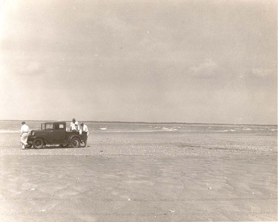
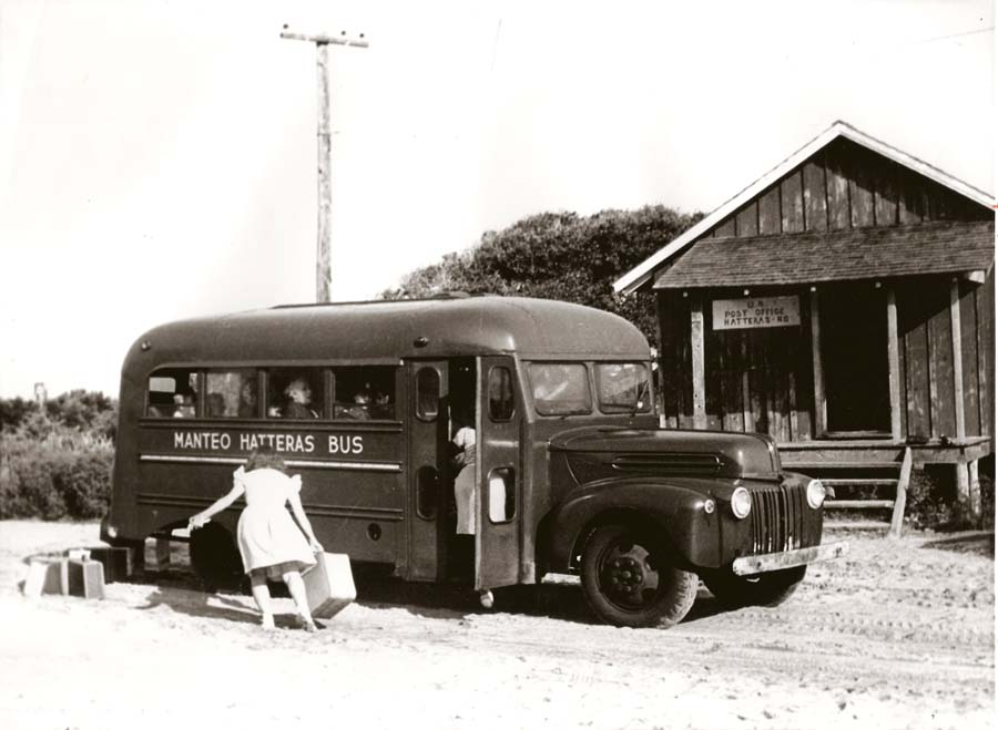
Early Days on the Beach
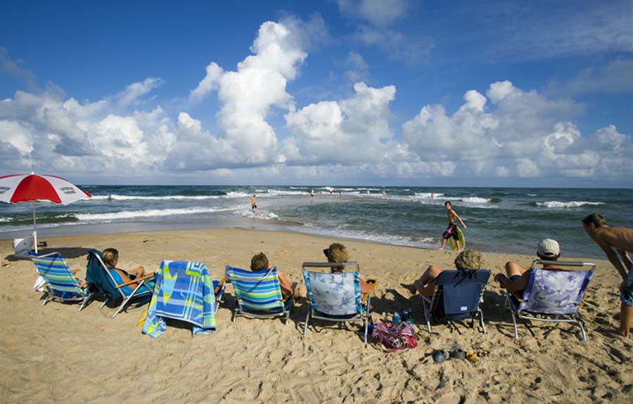
Sunny Day at the Point
Don't Be a Clown
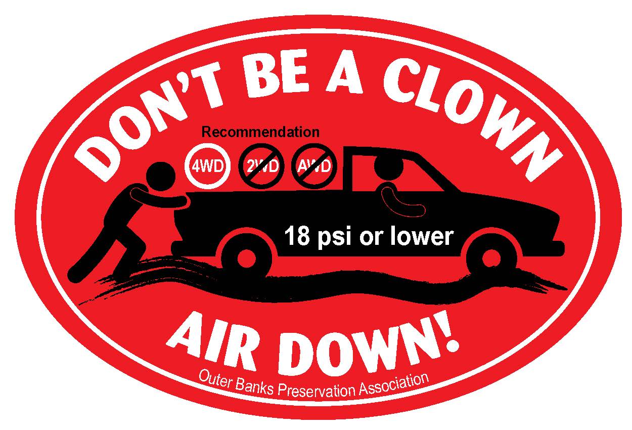
To request a free sticker visit a local tackle shop or send a stamped, self-addressed business envelope to:
OBPA-Don't Be a Clown
PO Box 1355
Buxton, NC 27920
Latest News
- Don't Be A Clown, Air Down!
- Beach Access - Spring 2018 .....
- A Significant Milestone....
- Proposed Rule Changes - Comments Due
- CHAPA Offers Reward for Information Regarding Green Sea Turtle Incident
- NPS Publishes Proposed ORV Rule Changes - Comment Period Open
- Nesting Sea Turtle Severely Injured on Cape Hatteras Beach
- NPS Releases EA for Proposed ORV Rule Changes
When the Beach was a Road
Current Beach Access Routes

Important Links